The Consortium, including our company, was the only entity that submitted a tender for implementation of the project – this is the best proof of the unique experience of our experts in this field. The maps we developed have a key impact on the inhabitants’ safety and enable informed planning of investments in the areas covered by the studies.
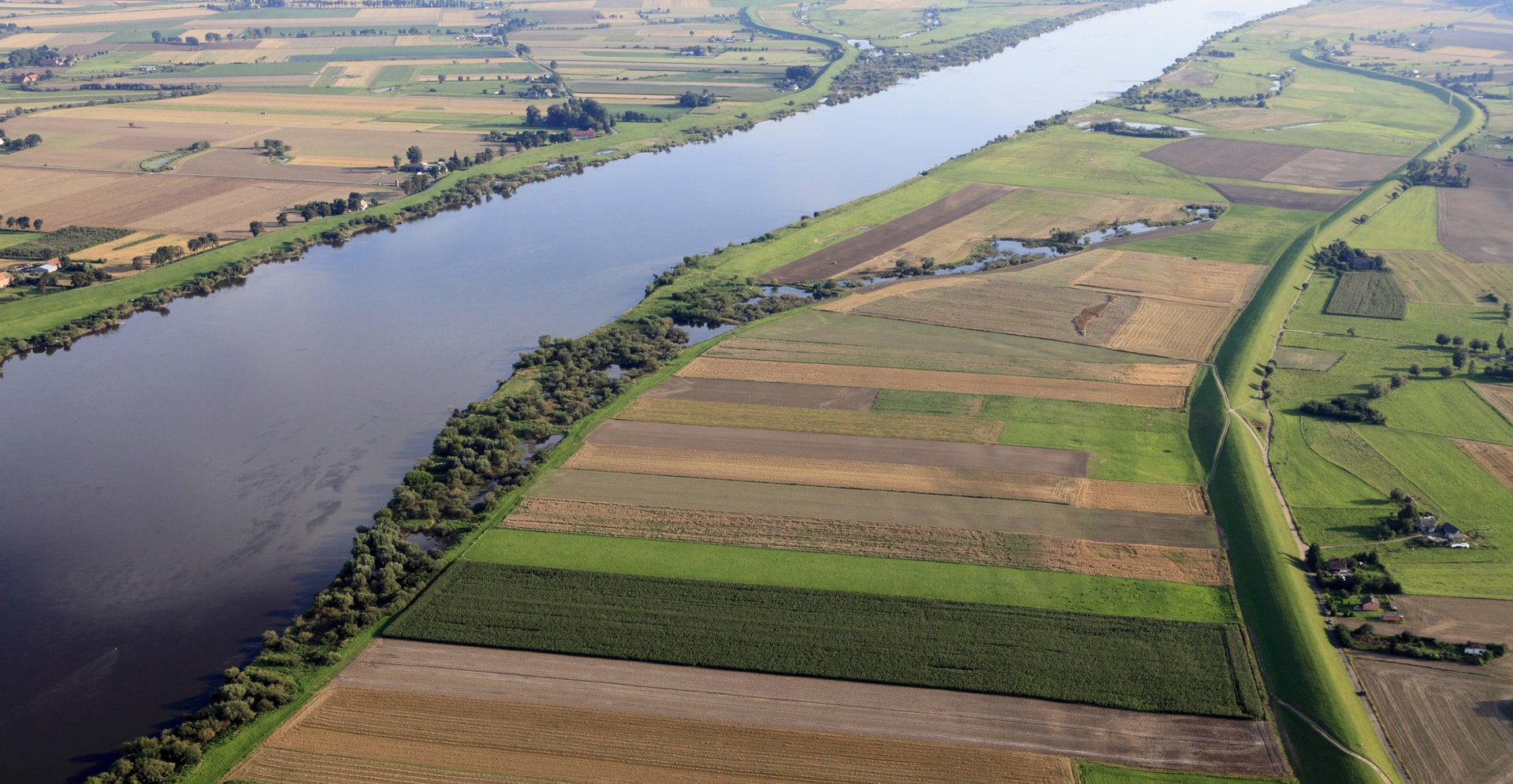
Table of Contents
The challenge
The aim of this project is to review and update the flood hazard maps and flood risk maps for Poland.
20,000 km of rivers
Scope of the study
Arcadis, as the Consortium partner, implemented a project commissioned by Krajowy Zarząd Gospodarki Wodnej Wody Polskie (Polish water management authority), aimed at reviewing and updating flood hazard maps and flood risk maps for Poland. Our company was responsible for the Water Region of the Upper Vistula River. The studies are a key contribution to flood risk management and reducing the consequences of flooding.
-
READ MORE
The results of Arcadis' work can be seen here. Thanks to general access to the maps, everyone (inhabitants, local governments, investors) can check whether they are in a flood hazard area.
The solution
The project required the involvement of a large number of experts – Arcadis had an appropriate team of experts and the required knowledge base at its disposal.
000 xxx
Lorem ipsum dolor
The scale of the project is impressive, covering the entire country. It is implemented by the Consortium which, apart from Arcadis, includes the Institute of Meteorology and Water Management (Consortium Leader) and MGGP S.A. The Water Region of the Upper Vistula River, which was implemented by Arcadis, is one of the areas in Poland with the highest flood risk – losses after flooding in 1997, 2001 and 2010 are estimated at over PLN 14 billion. The analyzed rivers in this area constitute about 30% of the length of all rivers for which the updated maps have been created.
The working methodology assumed the creation of four flood range scenarios – scenarios with a low (once every 500 years), medium (once every 100 years) and high (once every 10 years) flood risk, as well as a scenario of damage or destruction of banks for the areas where the rivers have flood banks. The second component of the project is the development of flood risk maps that indicate the number of people at risk of flooding and the potential material losses resulting from this.
-
READ MORE
The large scope of the work (> 20,000 km of rivers) required the involvement of a significant number of experts – Arcadis had an appropriate team of experts and the knowledge base required for the project.
The maps are developed and updated in connection with the implementation of the EU Floods Directive. This process is cyclical, taking place every 6 years. In the current planning cycle, an improved methodology has been applied. The study also covers the river sections not included in the first planning cycle.
The impact
Developing and updating flood hazard maps and flood risk maps has a key impact on the safety of inhabitants and material resources in the areas concerned.
XXX xxx
Lorem ipsum dolor
Developing and updating flood hazard maps and flood risk maps has a key impact on the safety of inhabitants and material resources in the areas covered by the studies. They are the basis for planning further action – establishing land development plans by local governments or planning investments.
-
READ MORE
They also have a key impact on determining the characteristics of the land development which can be carried out in a given area – they answer both the question “whether to build” and the question “how to build” in order to reduce the risk of flood-related losses without increasing this risk at the same time. They are also used as a basis for planning flood prevention measures – construction of flood banks, retention tanks and other related investments.
Behind the solution
Find out more about this project
We hope you enjoyed this story. It would be our pleasure to connect with you and discuss how we can help you improve the quality of life at your business.

Connect with Arcadis for more information & questions.
Not done reading?
This also might be interesting for you
- Related Projects
- Related Insights
- Related Blogs